Dove Mountain Hikers
Ironwood
Forest
National Monument
The
Ironwood Forest National Monument Monument is 129,000 acres.
It's boundary to the north is the north side of the
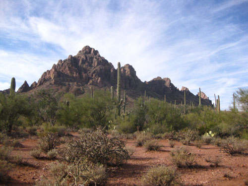
Sawtooth
Mountains
and the boundary to the south is the northern section of the
Roskruge
Mountains. It is difficult to include the entire Monument boundary
on one map and make it readable.
The western boundary is depicted in these maps by a heavy
yellow line.
These
maps were made by Dove Mountain Hikers and they have no
affiliation with the Friends of Ironwood Forest or with the BLM. The
tracks on these maps were created by actual GPS tracks recorded
during hikes in the Ironwood Forest National Monument, uploaded
to National Geographic Mapping Software which was used to
develop the attached Maps.
These
tracks do not represent trails.
They are routes that were hiked / bushwhacked to various
destinations. Also
BLM is currently drafting a revised Transportation Management
Plan for the IFNM and all the roads depicted on the map may not
be open after the transportation plan is finalized and approved.
Other
than volunteer work projects in the Sawtooth Mountains to the
north and El Cerrito de Represso off of Manville Road to the
south, all of the documented hiking has been in and adjacent to
the Waterman Mountains, Silver Bell Mountains and Ragged Top.
If you are planning to hike to one of the Peaks, it is advisable
to check in with BLM for safety updates and current road
information.
Ironwood
Forest
National Monument
Map
-
This
Map encompasses a large portion of the Monument.
Therefore, when first displayed, the Map is un-readable.
You must expand the Map on your computer and scroll to
the area you are interested in. The Map encompasses Ragged Top,
Silver
Bell
Mountains
and the
Waterman
Mountains
.
To further complicate the situation there are two
versions of this Map. One
version does not have GPS waypoints on the Map.
The other version does.
Ironwood
Map without waypoints
Ironwood
Map with waypoints
If you would like to get
GPS waypoints in UTM / NAD83 Format, to hike up to Ragged Top,
Silver bell Peak or
Waterman
Peak
, click on the following link:
Ironwood
Forest
Waypoint
Ragged
Top
-
The
routes on the Ragged Top Map contain four DM hikes to the summit
and volunteer work hikes in the immediate area. On
a side note, the BLM requests that hikers refrain from hiking
above Wolcott Saddle and summit-ting Ragged Top from January 1
through April 30 during the Big Horn Sheep Lambing Season.
Ragged
Top Map
Silver
Bell
Mountains
-
The
route on the Silver Bell Map is a hike to the Peak and volunteer
work hikes in the immediate area.
Silverbell
Mountains
Map
Waterman
Mountains
-
The
route on the Waterman Map is route to the Peak, many volunteer
work hikes in the area and extensive work at the Allyson
Kamataka Restoration Site.
Waterman
Mountains
Map
All
of the information shown on the Ragged Top, Silver
Bell Mountains and
Waterman
Mountains
Maps also appear on the
Ironwood
Forest
National Monument
Map.
DISCLAIMER:
Dove Mountain Hikers is a group of friends who hike
together. There are no hiking leaders and all those
who
participate are responsible for determining that
they are adequately prepared to engage in such
activities and that
they
do so solely at their own risk.
dovemountaincivicgroup.org